Request for Proposals
Open Request for Proposals
Applegate River Mile 25 Side Channel Design Project
Applegate River Mile 25 Side Channel Design Project
RFP Documents
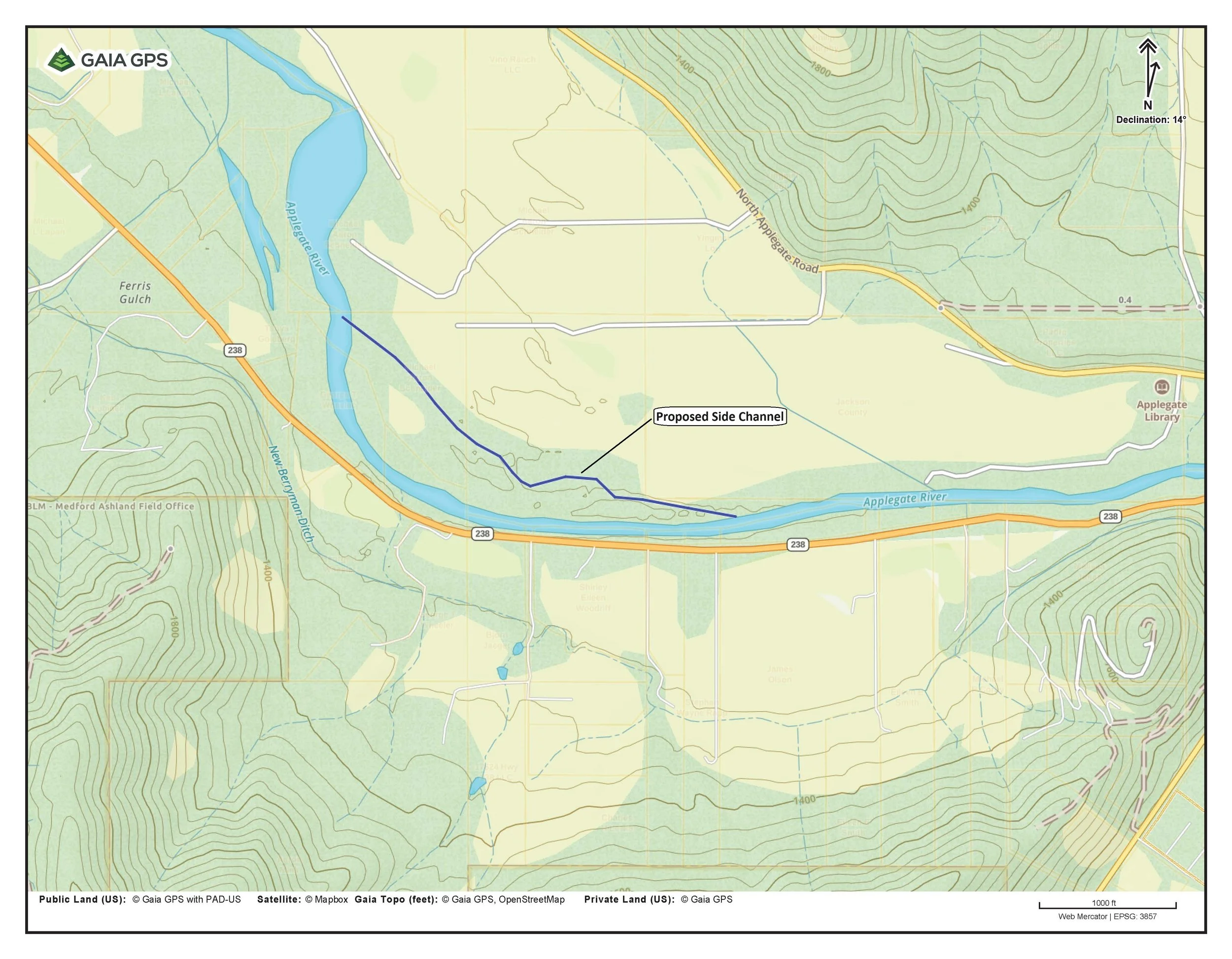
APWC is seeking proposals from qualified engineering firms to develop preliminary (65 %) design plans for the Applegate River Mile 25 Side Channel Restoration Project. The project will create detailed design drawings and cost estimates to reconnect and enhance side-channel habitat on private property along the Applegate River in southern Oregon.
The full RFP, including scope of work, schedule, and submission instructions, can be downloaded below.
Proposal Opens: Oct. 21, 2025
Proposal Due By: Friday Jan. 02, 2026, 5:00pm
Questions & Electronic Submissions
Luke Wimmer, Aquatic Restoration Program Director
luke@apwc.info | 541-890-9765
Paper Submissions can be dropped off at our office:
60 Upper Applegate Rd
Jacksonville, OR 97530
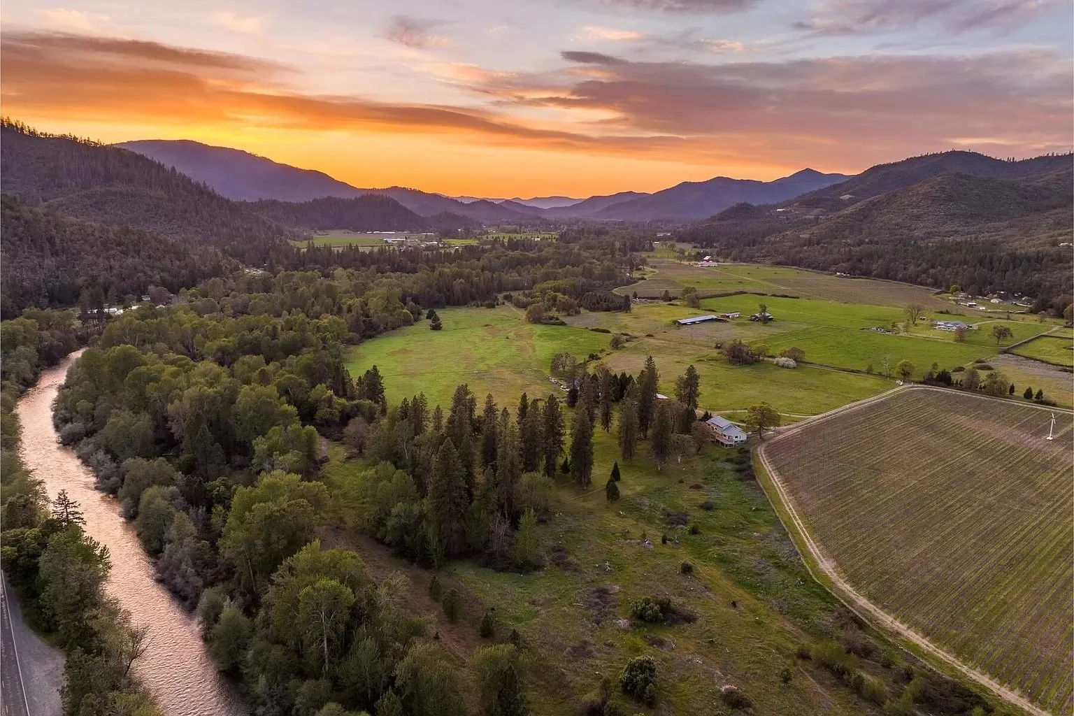
The Applegate River Mile 25 Side Channel Restoration Project aims to enhance salmon and steelhead habitat along a private stretch of the Applegate River near Murphy, Oregon. The project will reconnect a historic side channel, improve floodplain connectivity, and increase habitat complexity to support multiple life stages of native fish species, including ESA-listed Coho salmon.
Through this Technical Assistance grant, the selected engineering firm will develop preliminary (65%) design plans, hydraulic modeling, and cost estimates to guide future implementation. The project will build on previous restoration work in the Applegate watershed and is part of APWC’s broader effort to restore natural river processes and improve aquatic habitat in partnership with landowners, OWEB, ODFW, and other regional partners.
Project Description
(Closed) CHENEY CR. TRIB CULVERT REPLACEMENT PROJECT
RFP Documents and Invitation to Bid
The APWC is requesting proposals for our Cheney Creek Tributary Culvert Replacement Project. The project will replace an undersized, perched culvert on BLM Road 37‑7‑13 with a 9‑foot corrugated metal pipe (APWC to supply new culvert) built to stream simulation design standards. This work will restore fish passage, improve flood resilience, and reconnect high‑quality spawning and rearing habitat for salmon, steelhead, and other aquatic species.
Proposal Opens: Tuesday, Aug. 5, 2025
Optional Site Tour: Friday, Aug. 15, 2025 [Google Maps Pin]
Proposal Due By: Friday, Aug. 22, 2025 4pm
Questions & Electronic Submissions
Luke Wimmer, Aquatic Restoration Program Director
luke@apwc.info | 541-890-9765
Paper Submissions can be dropped off at our office:
60 Upper Applegate Rd
Jacksonville, OR 97530
Bid Package:
The Cheney Creek Tributary Culvert Replacement Project, led by APWC in partnership with the Bureau of Land Management- Grant Pass Field Office, will replace a failing, undersized culvert on a perennial tributary to Cheney Creek in Josephine County, Oregon. The existing 6.1‑foot‑wide, 4.6‑foot‑tall pipe arch culvert is perched above the streambed, blocking fish and aquatic organism passage and providing inadequate capacity for high‑flow events. The structure also fails to meet stream simulation design standards and 100‑year flood and debris passage requirements.
The replacement crossing will be constructed using an owner‑provided 9‑foot diameter corrugated metal pipe (CMP) designed to pass the 100‑year flood, bedload, and anticipated debris. The new structure will feature a natural streambed at the correct elevation and slope to meet stream simulation standards, restoring unimpeded passage for salmon, steelhead, and other aquatic species.
Project Description
(Closed) Cheney Creek & Iron Creek Box Culvert Replacement Preliminary Designs
RFP Documents
APWC is soliciting proposals from qualified engineering firms for preliminary (30%) design services to improve fish passage at two culvert barriers in Josephine County, Oregon. The projects—Iron Creek at Southside Road and Cheney Creek at Fish Hatchery Road—aim to restore aquatic connectivity, enhance public safety, and support future construction funding.
Firms may submit proposals for one or both sites.
Proposal Opens: July 30, 2025
Proposal Due By: Friday, September 5, 2025, 5:00pm
Questions & Electronic Submissions
Luke Wimmer, Aquatic Restoration Program Director
luke@apwc.info | 541-890-9765
Paper Submissions can be dropped off at our office:
60 Upper Applegate Rd
Jacksonville, OR 97530
APWC is leading the development of preliminary designs for two high-priority fish passage improvement projects in Josephine County. Both sites—Iron Creek at Southside Road and Cheney Creek at Fish Hatchery Road—are identified as partial barriers to native fish migration on ODFW’s fish passage priority list.
The Iron Creek project will evaluate low-cost modifications or culvert replacement options to improve passage while maintaining road function. The Cheney Creek project involves replacing an aging box culvert with a bridge and realigning the roadway to improve both ecological and public safety outcomes. This site is also expected to pursue federal construction funding, requiring design compliance with state and federal transportation standards.
Each project is supported by an Oregon Watershed Enhancement Board (OWEB) Technical Assistance Grant and will result in a 30% preliminary design package suitable for future funding and permitting.
Project Description
(Closed) FUELS REDUCTION PROJECT:
Upper Applegate All-Lands Wildfire Protection Project
RFP Documents
APWC is currently requesting proposals for the Upper Applegate All-Lands Wildfire Resiliency Project (UAAWRP). This large-scale effort will reduce wildfire risk and improve forest health across private lands in the Upper Applegate watershed through strategic fuels reduction treatments. The initial contract aims to treat at least 250 acres in Year 1, with the potential for multi-year extensions to expand the work to 750 acres. The selected contractor will lead landowner engagement, develop treatment prescriptions, manage implementation, and ensure compliance with project goals and federal funding requirements.
Proposal Opens: July 25, 2025
Proposal Due By: Friday, August 22, 2025, 5:00pm
Questions & Electronic Submissions
Nathan Gehres, Habitat Restoration Project Manager
nathan@apwc.info | 541-890-9989
Paper Submissions can be dropped off at our office:
60 Upper Applegate Rd
Jacksonville, OR 97530
The UAAWRP is a multi-year, landscape-scale effort to reduce wildfire risk and improve forest health across private lands in the Upper Applegate watershed. In Year 1, the project aims to treat at least 250 acres, with the potential to expand up to 750 acres over three years. APWC is seeking a primary contractor to lead on-the-ground implementation, including landowner outreach, prescription development, subcontractor management, treatment oversight, documentation, and compliance with federal funding requirements.
Treatments will follow a strategic, ecologically grounded approach focused on reducing hazardous fuels while promoting resilient, fire-adapted forests. Practices include variable density thinning, “thin and release” strategies, mosaic thinning around large, multi-aged trees, mastication, ladder fuel removal, and pile burning. The selected contractor must be capable of managing a large, geographically dispersed project area with minimal oversight, while maintaining regular communication and coordination with APWC staff.
Project Description
(CLOSED) PROVOLT RECREACTION SITE: LWD PROJECT
RFP Documents
The APWC is currently requesting proposals for our Williams Creek Aquatic Habitat Improvement Project at the Provolt Recreation Site. This project will enhance fish habitat in Williams Creek through the installation of 4-5 large wood structures (LWD) containing up to 100 logs. The structures will increase habitat complexity, provide essential shade and cover for aquatic species, and improve natural geomorphic processes in this reach of Williams Creek.
Proposal Opens: May 1, 2025
Pre-Bid Conference: Fri., May 16, 2025, 10:00am
Proposal Due By: Fri., May 30, 2025, 5:00pm
Questions & Electronic Submissions
Luke Wimmer, Project Manager
luke@apwc.info | 541-890-9765
Paper Submissions can be dropped off at our office:
60 Upper Applegate Rd
Jacksonville, OR 97530
Provolt Rec Site LWD Project- Bidders Packet Archived - Do Not Use
PRS – LWD Project: ADDENDUM #1 Updated Bid Packet_May 17, 2025
Bid Files
This project will install multiple large woody debris (LWD) structures on Williams Creek at the Provolt Recreation Site. The project area spans approximately 500 linear feet of Williams Creek and will involve the installation of 4-5 large wood structures containing up to 100 logs to improve habitat. Each structure will consist of 5-7 buried logs with root wads installed vertically, with an additional 10-15 intertwined logs strategically placed for stability during high-flow events. Since there are no mature trees or bedrock anchor points available near the stream to secure the logs, approximately 50 boulders (2-4 ft diameter) will be incorporated as ballast within the structures to provide additional stability. The design utilizes a 'field fit' approach where exact placement and configuration of structures will be determined on-site in collaboration with project partners. All restoration actions will be implemented in cooperation with APWC and the BLM.
The project site is located on BLM-managed land at the Provolt Recreation Site in Josephine County, Oregon. This location provides public access to Williams Creek, an important tributary in the Applegate watershed. The APWC is implementing this project in partnership with the Bureau of Land Management Grants Pass Field Office, with funding provided to improve aquatic habitat conditions for native fish species and overall watershed health in this reach of Williams Creek.
Project Description
(CLOSED) UPPER PHILLIPS DITCH EFFICIENCY PROJECT
General Information & Proposal Documents
The APWC will be requesting proposals for our Little Applegate Upper Phillips Ditch Efficiency Project. This project will improve the conveyance of irrigation water through the Upper Philips ditch while providing turn-outs for irrigation water to the local water users. This project is a partnership between the water users, Jackson Soil & Water Conservation District and the Applegate Partnership.
Proposal Opens: January 8, 2024
Pre-Bid Conference: Jan. 12, 2024, 1:30pm
Proposal Due By: Tues., Jan. 23, 2024, 2pm
Questions & Electronic Submissions
Final Date for Questions is 1/18/2024 by 2pm
Janelle Dunlevy, Executive Director
janelle@apwc.info | 541-899-9982
Paper Submissions can be dropped off at our project partner’s office:
Jackson Soil & Water Conservation District
In Care of: Paul DeMaggio, Upper Phillips Ditch Pipeline Project
89 Alder St. Central Point, OR 97502
Bid Files
The Little Applegate River Fish Passage and Irrigation Efficiency Project has improved fish passage by creating a bypass channel around the Upper Philips Dam, and installed a new fish screen. The completion of this project will improve irrigation efficiency with a water savings of over 85% through piping 1.8 miles of irrigation ditch with 12-inch diameter HDPE-pipe in order to provide water to 11 small-farms and residences in Jackson County within the Rogue River Basin. The project will improve irrigation infrastructure, improve agricultural production, allow production of additional acres, improve water quality, and enhance fish passage and instream flows for Endangered Species Act-listed and State-listed species including Coho salmon, Pacific lamprey, steelhead, and cutthroat trout. The project will dedicate conserved water instream for the benefit of aquatic species in a DEQ-listed flow-limited stream. This project is the result of a decade-long partnership between the Upper Philips Ditch Association and the Applegate Partnership and Watershed Council (APWC) and was developed in consultation with the landowners, the water users, Jackson County Soil Water Conservation District, OWRD, Bureau of Land Management, ODFW Fish Biologists, ODFW Fish Screens & Passage Program, Middle Rogue Steelheaders, Pacific Power Blue Sky Funds, Trout Unlimited, NOAA Restoration and the Rogue Basin Partnership.
Project Description
(CLOSED) CHENEY CR. TRIB CULVERT PROJECT
General Information & Proposal Documents
The APWC is requesting proposals for our Cheney Creek Tributary Culvert Replacement Project. This project will replace a undersized, failing culvert on a perennial tributary of Cheney Creek. Proposals will be for design and build.
Proposal Opens: Tuesday, Oct. 10, 2023
Pre-proposal Site Tour: Mon., Oct. 23, 2023, 1pm
Proposal Due By: Thurs., Nov. 9, 2023, 5pm (CLOSED)
Questions & Submissions
Nathan Gehres, Project Manager
nathan@apwc.info | 541-890-9989
Proposal Documents (2 files)
Project Description
This project will replace a failing culvert on a perennial tributary to Cheney Creek. Currently, this culvert does not have a stream simulation design and is currently a barrier to aquatic organism passage. It is also undersized and is “perched” about the streambed, creating a fish passage barrier.. The current culvert is a 6.1-foot wide, 4.6-foot-tall pipe arch culvert and has an estimated capacity of 60 cfs with allowance for debris flow and is about 40 feet long. The proposed replacement crossing will be an open bottom structure, a bridge or embedded culvert, depending on the results of the final design effort. The proposed replacement crossing will be designed to pass the 100-year flood, including an allowance for bed load, and anticipated floatable debris. A successful design will allow construct a stream bed at the correct elevation and slope to provide a stream simulation design through the structure and add to the habitat improvement investment on the mainstem of Cheney Creek. All restoration actions will be in cooperation with APWC and the BLM.
The project site is located on BLM managed land on the south side of the stream. The culvert is located on BLM Road 37-7-13 and provides public access and potential access for timber hauling to at least 3 miles of road and 4 square miles of public land above the stream crossing. There are private lands located beyond the BLM culvert. The APWC is working on this project in partnership with the BLM Grants Pass Field Office.
(CLOSED) WATTS TOPPIN FISH PASSAGE PROJECT
General Information & Proposal Documents
The APWC is requesting proposals for our Watts Toppin Fish Passage & Irrigation Improvement Project on Williams Creek near Provolt. This project, when completed, will provide volitional fish passage while maintaining two irrigation points of diversion.
Proposal Opens: Monday, Sept. 11, 2023
Mandatory Pre-proposal Site Tour: Mon., Oct. 2, 2023, 2pm
Proposal Due By: Wednesday, Oct. 18, 2023, 5pm (CLOSED)
Questions & Submissions
Luke Wimmer, Project Manager
luke@apwc.info | 541-890-9765
Proposal Documents (4 files)
Project Description
The primary goal of this project is to provide year-round volitional fish passage to all life stages and species at the Watts Toppin Dam while providing irrigation water to the water users by constructing a roughened channel (engineered riffle). The dam currently is a major fish passage barrier that limits access to high quality habitat including 12 miles for Chinook, 23 miles for Coho, 35 miles for Steelhead, and 11 miles for Pacific Lamprey. A similar design was successfully constructed at Lower Bridgepoint Dam, a dam located a mile downstream in 2020.
Watts Toppin Dam is listed on the Oregon Department of Fish and Wildlife (ODFW) Statewide Fish Passage Priority List as the 4th highest priority in the Applegate Watershed. The 3 higher priorities are currently in varying stages of planning and/or design for removal or retrofit by APWC and/or other entities. The proposed project seeks to build upon the recently completed Lower Bridgepoint Fish Passage Project, located on BLM land approximately 1 mile downstream of Watts Toppin Dam. The successfully completed project at Lower Bridgepoint Diversion was similar in scale and design to the proposed project at Watts Toppin. Together, these projects will substantially improve access to valuable upstream spawning and rearing habitats of Williams Creek and its tributaries.


